Rupert Parker’s guide to walking La Palma explores the most north-westerly of the Canaries.
La Palma is apparently the world’s steepest island, something to bear in mind when you’re considering hiking its network of trails. You are going to need this guide to walking La Palma.
As I taxi down the runway at La Palma airport, I have the sea on one side and the mountains on the other. Unfortunately, the clouds are low so I’ve no way of judging how hard the walking is going to be, but I can make out the land climbing steeply into the mist. It looks like this guide to walking La Palma is going to be tough.
La Palma is not your normal Canary island since it’s been relatively untouched by mass tourism. There are only a handful of resorts, the beaches are black and, because of its position in the Atlantic, it attracts more cloud and rain than the others. However, that also makes it the greenest, with lush vegetation in the north and thick pine forests in the mountainous centre. In fact, the whole island was declared a UNESCO Biosphere Reserve in 2002.
Santa Cruz de La Palma
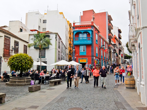
The capital sits at sea level and it was a major halt on the way to and from Central and South America from the 16th century onwards. At one point it was the third most important port in the Spanish empire just behind Seville and Antwerp. These days it’s just the ferry to Tenerife and a couple of large cruise ships that moor here, but the historic old town is still remarkably intact.
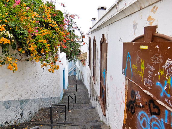
The town doesn’t take long to explore as it’s not much more than a couple of long streets running parallel to the sea, on different levels, Still, they’re lined with renaissance churches, vintage shop fronts and imposing 18th-century mansions. Everything revolves around the Plaza de Espana which has the town hall on one side and the fortress-like 16th-century El Salvador church opposite. Inside, the ornate canary pine ceiling is a fine example of Mudéjar or Islamic-style architecture.
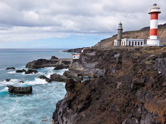
Rutas de los Volcanoes
La Palma is an island on the move, with volcanic activity adding land in the south, most recently in 1971. Strong seismic activity was detected in 2017 prompting speculation that another eruption is due. There’s an informative visitor centre here which details the geology and also has footage of the last eruption. There’s also a seismograph constantly monitoring volcanic activity, and today it looks like it’s safe to go outside.
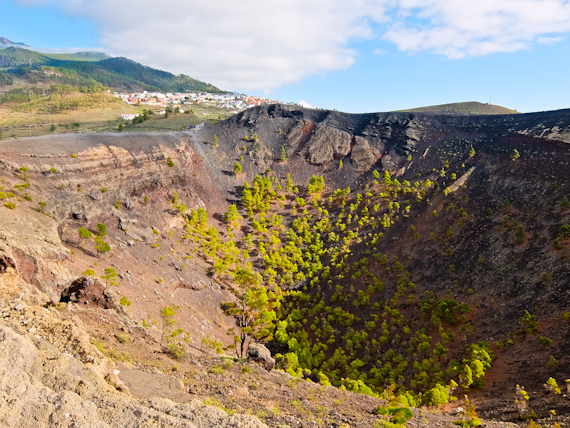
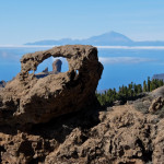
Walking around the crater of the San Antonio volcano is my first challenge, formed by a year-long eruption in 1677. The edge of the cone is narrow and there are stunning views into the crater, and across to the town of Fuencaliente. I carry on across the black barren volcanic landscape, aiming for the southernmost point of the island. On my way is the Teneguía volcano, which erupted in 1971 and I can’t resist climbing to the top. There’s a distinctive smell of sulphur and its lower slopes are populated by vines. The volcanic soil, coupled with the sea breezes, is responsible for producing some of La Palma’s distinctive wines
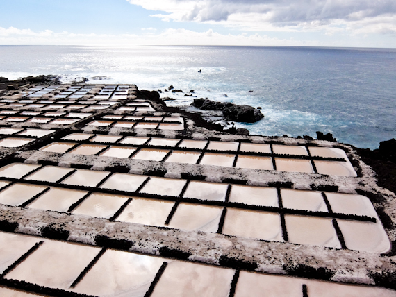
The route carries on downhill along what is the last section of the Rutas de Volcanes, a longer trail which starts on the heights in the middle of the island. At the end are a couple of lighthouses and a collection of salt pans, still used for harvesting flor de sal. It’s now lunchtime and I sit on the terrace of the El Jardín de la Sal enjoying fresh fish and a glass of the local wine.
Pico de Bejenado
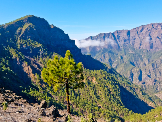
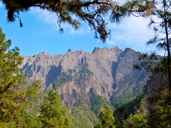
Next morning the mountains are free of cloud so I drive upwards through a complex of hairpins and tunnels to the centre of the island and the Taburiente National Park. I’m planning to climb the 1854m Pico de Bejenado and manage to cheat a little by driving up to 1100m on a primitive dirt road. The path leads through lush Canary pines before reaching a saddle with views down into the Caldera de Taburiente. This was once a volcanic mountain before it collapsed into itself creating an impressive 8km wide crater.
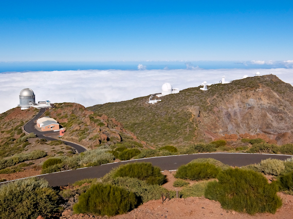
The only way is up, so I continue climbing to the summit. From here I can see the rocky lumps of Roque de Los Muchachos, the highest point in the island at 2426m. Because conditions are perfect for star gazing, they’ve sited an observatory complex near the summit and populated it with some of the world’s largest telescopes. A few days later, I drive up there and the domes of the telescopes, standing clear of the cloud below, are like something from a sci-fi movie.
Star Gazing
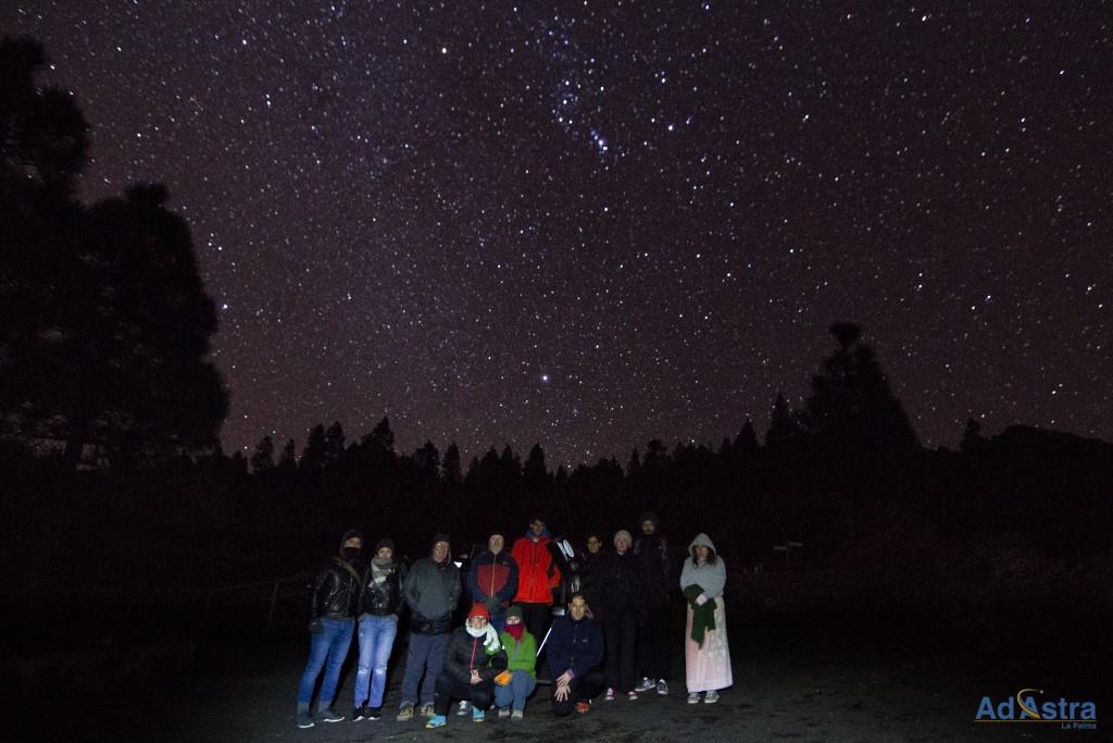
Although there are day tours of the observatory, visitors are only allowed during the day for obvious reasons. You can still see the sky at night either on your own, or on a guided viewing. I join Ad Astra, just after sunset, near Refugio de Pilar where the guide has already set up her telescope. Down below I’d been engulfed in mist, but up here all is clear and rather cold. Various constellations are pointed out, including Orion’s Belt, Cassiopeia and the Great Bear, while taking turns peering through the telescope. Fuzzy images of binary stars, the Andromeda Nebula and the Pleiades are some of the things I’m told I’m seeing.
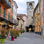
Los Llanos
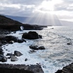
I move from Santa Cruz to the town of Los Llanos, in the west of the island, and a good base to further explore the Taburiente National Park. Home to thick Canary pine forests, riven by deep ravines, and impressive rock formations, it’s been protected since 1954. The best way to explore is on foot although the hiking trails are pretty demanding. A classic circular hike starts just outside Los Llanos and follows the Barranco de las Angustias, the “Ravine of Anguish”, a deep gash with a fast flowing river at its base.
At the car park, I take a taxi up to Los Brecitos and avoid a long hard slog uphill. From here, the path is pleasant underfoot and winds through pine forests and patches of laurisilva, a green way linked by wooden bridges. I cross the river to reach the only National Park’s only campsite before descending on the other side of the ravine. If there’s rain, this route is impassable, but today there’s little water and I follow the river bed back to my car.
Refugio de Pilar
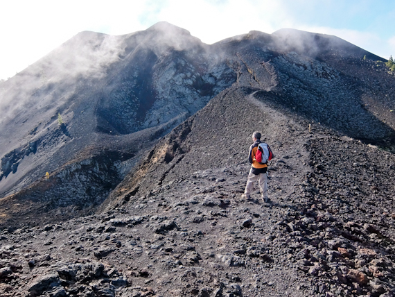
In this guide to walking La Palma, the toughest long-distance route in the Canaries is the GR131. It starts at sea level in the north, climbs up to Roque de Los Muchachos, before descending to the lighthouses in the south. I’ve already done the last part but feel I should hike the rest of the Ruta de los Volcanes.
Refugio de PilarI is where I join the GR131 and climb up through pines with glimpses of Montana Quemada which erupted in 1480. The trees give way to a stony ash path, following the ridge of extinct volcanoes, with views of solidified black lava flows to the side. Along the way, I tick off Pico Birigoyo, Montaña la Barquita, Montaña de los Charcos and Hoyo Negro.
The mist is swirling and there are sudden strong gusts of wind and it’s tricky to keep upright. I manage to reach the summit of Volcan de la Deseada, the highest point of the route at almost 2000m, but my guide decides it’s dangerous to continue. We drop down and take a forestry path back to the start point, just as the rain starts. I feel slightly disappointed that I haven’t managed the whole trail, but now I have a good reason to come back to do another guide to walking La Palma.
Tell me more about this Guide to walking La Palma
in this guide to walking La Palma, hiking paths are well signed and excellently maintained and Senderos de la Palma has up-to-date information. There’s a good bus network but you’ll need a car to get to the high points.
Cicerone’s Walking on La Palma, by Paddy Dillon, is an excellent guide.
Visit La Palma has information about the island and a guide to walking La Palma
EasyJet offers direct flights from London Gatwick to Santa Cruz de La Palma, operating twice a week on Tuesdays and Saturdays. Return flights are currently priced from £99.00.
The Gatwick Express is the fastest way to get to the airport from central London.
Hotel H10 Taburiente Playa **** in Los Cancajos makes a comfortable base near Santa Cruz.
Valle de Aridane Hotel and Hotel Benahore are both good options in Los Llanos centre.
El Duende del Fuego, in Los Llanos, serves local food in an imaginative way.
Bodegón Tamanca, in San Nicolas, is excellent for meat dishes.
Kiosko Teneguía, in Puerto de Tazacorte, has fresh fish dishes,
Restaurante Briesta, near Garafia, is good for traditional cooking.